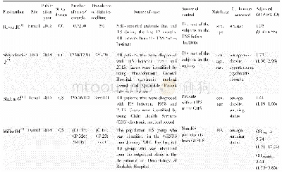
《Table 1 Main characteristics of research sites》
 提示:宽带有限、当前游客访问压缩模式
本系列图表出处文件名:随高清版一同展现
《Efficiency of soil and water conservation practices in different agro-ecological environments in the Upper Blue Nile Basin of Ethiopia》
Note:Moist Kolla,500–1500 m a.s.l.,mean annual precipitation of 900–1400 mm;Moist Weyna Dega,1500–2300 m a.s.l.,mean annual precipitation of 900–1400 mm;Wet Dega,2300–3200 m a.s.l.and mean annual precipitation of≥1400 mm (Hurni et al.,2016;Nigu
The values of various soil variables were determined to characterize each site(Table 1).Three samples were taken from the top 30 cm of the soil profile at intervals of 10 cm for each land use type and analyzed to determine the texture using the hydrometric method(Sheldrick and Wang,1993)and the average of the particle-size distributions were used to characterize the site.Undisturbed soil samples were taken to a depth of 30 cm at 10-cm intervals using a core sampler with a volume of 100 cm3 to determine the soil bulk density to determine the bulk density.The samples were then oven-dried at 105°C for 24 h and weighed.The bulk density was determined by dividing the weight of the oven-dried soil samples by the volume of the soil core.Soil penetration resistance(SPR (k Pa)) was measured by using a hand-operated soil cone penetrometer(Hand penetrometer,Eijkelkamp Company,the Netherlands)with a cone(2-cm2 base size)and a driving shaft graduated at 5-cm intervals.For each site,we calculated the SPR as the average of30 observations.
| 图表编号 | XD0020358900 严禁用于非法目的 |
|---|---|
| 绘制时间 | 2018.04.01 |
| 作者 | Dagnenet SULTAN、Atsushi TSUNEKAWA、Nigussie HAREGEWEYN、Enyew ADGO、Mitsuru TSUBO、Derege T MESHESHA、Tsugiyuki MASUNAGA、Dagnachew AKLOG、Ayele A FENTA、Kindiye EBABU |
| 绘制单位 | The United Graduate School of Agricultural Sciences, Tottori University、School of Civil and Water Resource Engineering, Institute of Technology, Bahir Dar University、Arid Land Research Center, Tottori University、International Platform for Dryland Research |
| 更多格式 | 高清、无水印(增值服务) |

![表2 HBV基本核心启动子区与前C区主要突变位点的变异率比较[例, 率 (%) ]Table 2 Mutation rate of the main acidic sites of the BCP/Pre-C regions of the](http://bookimg.mtoou.info/tubiao/gif/BDXB201804005_11500.gif)


