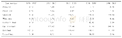
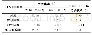
《Tab.4 The single dynamic index of land use in distinct parts of Kuye River Basin》
 提示:宽带有限、当前游客访问压缩模式
%
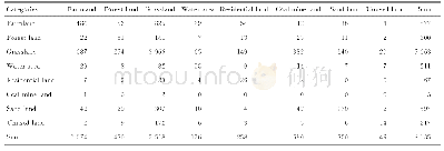
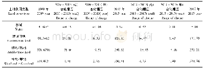
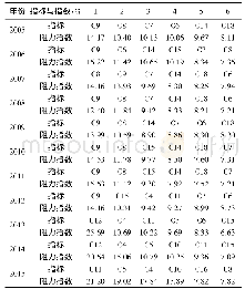
Form the analysis results of the land use transfer matrix and the single dynamic degree of land use type,it can be seen that the areas of farmland and coal mine land changed apparently from1980to 2018,which was mainly caused by the combination of natural and social-economic factors.In order to explore the driving factors influencing changes in land use types in the Kuye River Basin,we should deeply analyze the driving factors and obtain their rules influencing the change process of land use,so as to reasonably predict the changing trends in future.
| 图表编号 | XD00152759400 严禁用于非法目的 |
|---|---|
| 绘制时间 | 2020.08.25 |
| 作者 | 蒋晓辉、高昊祺、雷宇昕 |
| 绘制单位 | 西北大学陕西省地表系统与资源环境承载力重点实验室、西北大学城市与环境学院、西北大学陕西省地表系统与资源环境承载力重点实验室、西北大学城市与环境学院、西北大学陕西省地表系统与资源环境承载力重点实验室、西北大学城市与环境学院 |
| 更多格式 | 高清、无水印(增值服务) |
