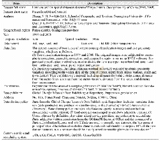
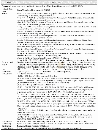
《Table 1 Metadata summary of“Land use and the spatial distances dataset of Panyu district,Guangzhou
 提示:宽带有限、当前游客访问压缩模式
本系列图表出处文件名:随高清版一同展现
《"广州市番禺区土地利用及空间距离数据集(1999,2008)"》
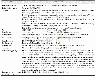
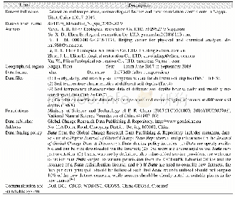
The metadata of“Land use and the spatial distances dataset of Panyu district,Guangzhou city of China(1999,2008)”[11]is summarized in Table 1,including the dataset full name,short name,authors,year of the dataset,temporal resolution,spatial resolution,data format,data size,data files,data publisher,and data sharing policy,etc.
| 图表编号 | XD00110333200 严禁用于非法目的 |
|---|---|
| 绘制时间 | 2019.09.25 |
| 作者 | 张亦汉、乔纪纲 |
| 绘制单位 | 广东财经大学地理与旅游学院、广东财经大学地理与旅游学院 |
| 更多格式 | 高清、无水印(增值服务) |