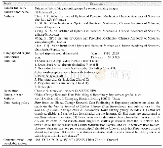
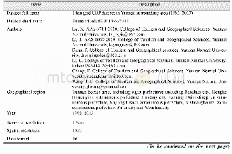
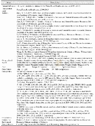
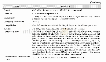
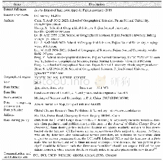
《Table 1 Metadata summary of“In situ dataset of land cover types in Fujian province(2019)”》
 提示:宽带有限、当前游客访问压缩模式
本系列图表出处文件名:随高清版一同展现
《福建省2019年土地覆被类型4846个样本点数据集的内容与调查过程》
The indoor inspection was conducted through Aowei Interactive Map,Google Earth and ArcGIS.Firstly,longitude and latitude of all the sampling points were input into ArcGIS and were digitized according to the questionnaire.Then,all the sampling points were checked with photos,marks in Aowei Interactive Map and Google Earth image to ensure that they were strictly set as the center of a pure area at least larger than 30 m?30 m.Wrong and repeated sampling points were removed during the check.Finally,all the sampling points were classified and sorted out according to Table 2 and were output in the formats of.shp and.kmz.
| 图表编号 | XD00153332700 严禁用于非法目的 |
|---|---|
| 绘制时间 | 2020.03.25 |
| 作者 | 陈耀亮、黄鑫毅、陆灯盛、刘姗姗、林文科、彭仲炜、吴燕芳、逄诗韵、赵帅 |
| 绘制单位 | 福建师范大学地理科学学院、福建师范大学地理科学学院、福建师范大学地理科学学院、福建师范大学地理科学学院、福建师范大学地理科学学院、福建师范大学地理科学学院、福建师范大学地理科学学院、福建师范大学地理科学学院、福建师范大学地理科学学院 |
| 更多格式 | 高清、无水印(增值服务) |
