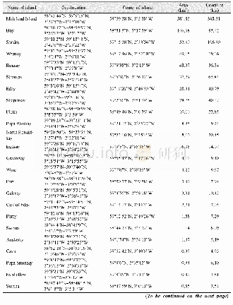
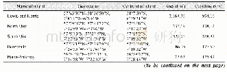
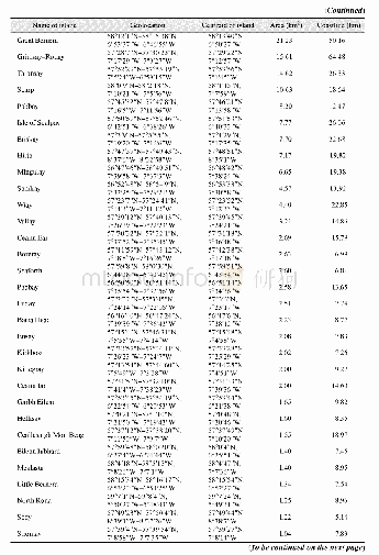
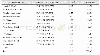
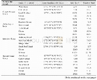
《Table 1 Geo-location,area and coastline of main islands of the Orkney Islands》
 提示:宽带有限、当前游客访问压缩模式
The dataset was developed based on the Google Earth and related maps and references[1–3].The dataset is consisted of 15 data files and archived in the.kmz and.shp[4]data formats with the data size of 6.29 MB(Compressed to 2.72 MB in two files).
| 图表编号 | XD00110320500 严禁用于非法目的 |
|---|---|
| 绘制时间 | 2019.06.25 |
| 作者 | 张应华、刘闯、石瑞香 |
| 绘制单位 | 中国科学院地理科学与资源研究所、中国科学院地理科学与资源研究所、中国科学院地理科学与资源研究所 |
| 更多格式 | 高清、无水印(增值服务) |

