《黄海埋藏古河道及灾害地质图集》
| 作者 | 李凡,张秀荣等著 编者 |
|---|---|
| 出版 | 济南:济南出版社 |
| 参考页数 | 138 |
| 出版时间 | 1998(求助前请核对) 目录预览 |
| ISBN号 | 780629385X — 求助条款 |
| PDF编号 | 88764808(仅供预览,未存储实际文件) |
| 求助格式 | 扫描PDF(若分多册发行,每次仅能受理1册) |
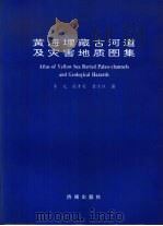
Fig.17 Distribution of geohazard faltors in the Yellow Sea (below sea bottom)1
Fig.1 High resolution geophysical survey lines in the Yellow Sea1
图1黄海高分辨地球物理测线1
图2冬季黄海海流分布2
Fig.2 Distribution of the Yellow Sea current (in winter)2
Fig.3 Distribution of the Yellow Sea current (in summer)3
图3夏季黄海海流分布3
图4冬季黄海水团分布4
Fig.4 Distribution of water mass in the Yellow Sea (in winter)4
图5夏季黄海水团分布5
Fig.5 Distribution of water mass in the Yellow Sea (in summer)5
Fig.6 Distribution of quasi-maximum velocity of tidal current in the Yellow Sea6
图6黄海平均近最大潮流(cm/s)分布6
Fig.7 Submarine topography in the Yellow Sea7
图7黄海海底地形7
图8黄海海底地貌8
Fig.8 Submarine geomorphology in the Yellow Sea8
图9黄海海底三维地貌9
Fig.9 Three dimensional submarine geomorphological map9
Fig.10 Distribution of sedimentary types in the Yellow Sea10
图10黄海海底沉积物类型分布10
图11黄海海底沉积物沙/粉沙+粘土比值等值线11
Fig.11 Distribution of ratio of sand/silt+clay in sediments in the Yellow Sea11
图12黄海全新世沉积物厚度(m)分布12
Fig.12 Distribution of Holocene sedimentary thickness in the Yellow Sea12
Fig.13 Distribution of buried paleo-channel belts in the Yellow Sea at the end of Late Pleistocene low stand of sea level13
图13晚更新世末期黄海埋藏古河道带分布13
图14黄海构造区划14
Fig.14 Geological Tectonic division in the Yellow Sea14
Fig.15 Distribution of the earthquake epifocus and intensity in the Yellow Sea15
图15黄海地震震中及地震强度分布15
Fig.16 Distribution of geohazard faltors in the Yellow Sea (Sea bottom)16
图16黄海灾害性地质因素分布(海底表面)16
图17黄海灾害性地质因素分布(海底以下)17
Fig.18 Zoning of geohazard in the Yellow Sea (sea bottom)18
图18黄海灾害地质分区(海底表面)18
Fig.19 Zoning of geohazard in the Yellow Sea (below sea bottom)19
图19黄海灾害地质分区(海底以下)19
Fig.20 Buried paleo-channel Survey line Ⅱ-4 st.2920
图20埋藏古河道 测线Ⅱ-1 测点2920
Fig.21 Buried paleo-channel Survey line Ⅱ-4 st.4121
图21埋藏古河道 测线Ⅱ-4 测点4121
图22埋藏古河道 测线Ⅴ-6 测点7222
Fig.22 Buried paleo-channel Survey line Ⅴ-6 st.7222
Fig.23 Buried paleo-channel Survey line Ⅱ-4 st.5623
图23埋藏古河道 测线Ⅱ-4 测点5623
图24埋藏古河道 测线Ⅲ-1 测点3824
Fig.24 Buried paleo-channel Survey line Ⅲ-1 st.3824
图25埋藏古河道 测线Ⅳ-5 测点625
Fig.25 Buried paleo-channel Survey Line Ⅵ-5 st.625
图26埋藏古河道 测线Ⅲ-2 测点2126
Fig.26 Buried paleo-channel Survey Line Ⅲ-2 st.2926
Fig.27 Buried paleo-channel Survey line Ⅲ-5 st.3827
图27埋藏古河道 测线Ⅲ-5 测点3827
图28埋藏古河道 测线Ⅰ-4 测点828
Fig.28 Buried paleo-channel Survey line Ⅰ-4 st.828
Fig.29 Buried paleo-channel Survey line Ⅺ-1 st.429
图29埋藏古河道 测线Ⅺ-1 测点429
Fig.30 Buried paleo-channel Survey line Ⅱ-4 st.5730
图30埋藏古河道 测线Ⅱ-4 测点5730
图31埋藏古河道 测线Ⅰ-4 测点1431
Fig.31 Buried paleo-channel Survey line Ⅰ-4 st.1431
图32埋藏古河道 测线Ⅴ-4 测点432
Fig.32 Buried paleo-channel Survey line Ⅴ-4 st.432
图33埋藏古河道 测线Ⅴ-4 测点2033
Fig.33 Buried paleo-channel Survey line Ⅴ-4 st.2033
图34埋藏古河道 测线Ⅴ-6 测点9234
Fig.34 Buried paleo-channel Survey line Ⅴ-6 st.9234
Fig.35 Buried paleo-channel Survey line Ⅵ-1 st.435
图35埋藏古河道 测线Ⅵ-1 测点435
Fig.36 Buried paleo-channel Survey line Ⅰ-4 st.2836
图36埋藏古河道 测线Ⅰ-4 测点2836
Fig.37 Buried paleo-channel Survey line Ⅰ-4 st.4137
图37埋藏古河道 测线Ⅰ-4 测点4137
Fig.38 Buried paleo-channel Survey line Ⅰ-11 st.1638
图38埋藏古河道 测线Ⅰ-11 测点1638
图39埋藏古河道 测线Ⅰ-11 测点2639
Fig.39 Buried paleo-channel Survey line Ⅰ-11 st.2639
图40埋藏古河道 测线Ⅱ-4 测点740
Fig.40 Buried paleo-channel Survey line Ⅱ-4 st.740
图41埋藏古河道 测线Ⅱ-4 测点3441
Fig.41 Buried paleo-channel Survey line Ⅱ-4 st.3441
图42埋藏古河道及活动性断层 测线Ⅲ-2 测点1742
Fig.42 Buried paleo-channel and active fault Survey line Ⅲ-2 st.1742
图43埋藏古河道 测线Ⅳ-2 测点743
Fig.43 Buried paleo-channel Survey line Ⅳ-2 st.743
图44埋藏古河道 测线Ⅴ-6 测点9644
Fig.44 Buried paleo-channel Survey line Ⅴ-6 st.9644
图45埋藏古河道 测线Ⅴ-7 测点3045
Fig.45 Buried paleo-channel Survey line Ⅴ-7 st.3045
图46埋藏古河道 测线Ⅴ-7 测点6346
Fig.46 Buried paleo-channel Survey line Ⅴ-7 st.6346
Fig.47 Buried paleo-channel Survey line Ⅴ-7 st.6547
图47埋藏古河道 测线Ⅴ-7 测点6547
Fig.48 Buried paleo-channel Survey line Ⅵ-1 st.1448
图48埋藏古河道 测线Ⅵ-1 测点1448
图49埋藏古河道 测线Ⅵ-1 测点1849
Fig.49 Buried paleo-channel Survey line Ⅵ-1 st.1849
图50埋藏古河道 测线Ⅵ-2 测点2250
Fig.50 Buried paleo-channel Survey line Ⅵ-2 st.2250
Fig.51 Buried paleo-channel Survey line Ⅵ-4 st.3451
图51埋藏古河道 测线Ⅵ-4 测点3451
图52埋藏古河道 测线Ⅶ-1 测点7252
Fig.52 Buried paleo-channel Survey line Ⅶ-1 st.7252
Fig.53 Buried paleo-channel Survey line Ⅶ-1 st.8353
图53埋藏古河道 测线Ⅶ-1 测点8353
图54埋藏古河道 测线Ⅶ-2 测点2154
Fig.54 Buried paleo-channel Survey line Ⅶ-2 st.2154
Fig.55 Buried paleo-channel Survey line Ⅺ-1 st.1055
图55埋藏古河道 测线Ⅺ-1 测点1055
Fig.56 Buried paleo-channel Survey line Ⅺ-1 st.2756
图56埋藏古河道 测线Ⅺ-1 测点2756
图57埋藏古河道 测线Ⅺ-2 测点557
Fig.57 Buried paleo-channel Survey line Ⅺ-2 st.557
Fig.58 Buried paleo-channel Survey line Ⅺ-2 st.1858
图58埋藏古河道 测线Ⅺ-2 测点1858
Fig.59 Buried paleo-channel Survey line Ⅺ-2 st.2159
图59埋藏古河道 测线Ⅺ-2 测点2159
Fig.60 Buried paleo-channel Survey line Ⅺ-3 st.1660
图60埋藏古河道 测线Ⅺ-3 测点1660
Fig.61 Buried paleo-channel Survey line Ⅺ-3 st.2161
图61埋藏古河道 测线Ⅺ-3 测点2161
图62老黄河-淮河-长江复合三角洲 测线Ⅰ-10 测点2062
Fig.62 Old Huanghe-Huaihe-Yangtze Rivers compound delta Survey line Ⅰ-10 st.2062
Fig.63 Buried paleo-delta Survey line Ⅱ-4 st.563
图63埋藏古三角洲 测线Ⅱ-4 测点563
Fig.64 Buried paleo-delta Survey line Ⅴ-4 st.264
图64埋藏古三角洲 测线Ⅴ-4 测点264
图65埋藏古三角洲 测线Ⅴ-6 测点8065
Fig.65 Buried paleo-delta Survey line Ⅴ-6 st.8065
Fig.66 Buried paleo-delta Survey line Ⅴ-7 st.1566
图66埋藏古三角洲 测线Ⅴ-7 测点1566
Fig.67 Buried paleo-delta Survey line Ⅴ-7 st.5967
图67埋藏古三角洲 测线Ⅴ-7 测点5967
Fig.68 Buried paleo-delta Survey line Ⅵ-4 st.1469
图68埋藏古三角洲 测线Ⅵ-4 测点1469
图69埋藏古三角洲 测线Ⅶ-2 测点1770
Fig.69 Buried paleo-delta Survey line Ⅶ-2 st.1770
Fig.70 Buried paleo-lake Survey line Ⅰ-4 st.3371
图70埋藏古湖泊 测线Ⅰ-4 测点3371
图71埋藏古湖泊 测线Ⅰ-11 测点972
Fig.71 Buried paleo-lake Survey line Ⅰ-11 st.972
Fig.72 Buried paleo-lake Survey line Ⅱ-1 st.1073
图72埋藏古湖泊 测线Ⅱ-1 测点1073
Fig.73 Buried paleo-lake Survey line Ⅳ-2 st.3474
图73埋藏古湖泊 测线Ⅳ-2 测点3474
图74埋藏古湖泊 测线Ⅳ-3 测点1775
Fig.74 Buried paleo-lake Survey line Ⅳ-3 st.1775
图75埋藏古湖泊 测线Ⅳ-5 测点1576
Fig.75 Buried paleo-lake Survey line Ⅳ-5 st.1576
图76埋藏古湖泊 测线Ⅴ-5 测点1077
Fig.76 Buried paleo-lake Survey line Ⅴ-5 st.1077
图77埋藏古湖泊 测线Ⅵ-4 测点3078
Fig.77 Buried paleo-lake Survey line Ⅵ-4 st.3078
Fig.78 Buried paleo-coast line Survey line Ⅱ-1 st.2679
图78埋藏古海岸线 测线Ⅱ-1 测点2679
Fig.79 Lower buried paleo-channel Survey line Ⅵ-4 st.3780
图79下层埋藏古河道 测线Ⅵ-4 测点3780
Fig.80 Lower buried paleo-channel Survey line Ⅶ-1 st.9481
图80下层埋藏古河道 测线Ⅶ-1 测点9481
图81下层埋藏古河道 测线Ⅶ-2 测点2582
Fig.81 Lower buried paleo-channel Survey line Ⅶ-2 st.2582
图82下层埋藏古河道 测线Ⅺ-1 测点2483
Fig.82 Lower buried paleo-channel Survey line Ⅺ-1 st.2483
图83下层埋藏古湖泊 测线Ⅵ-1 测点1084
Fig.83 Lower buried paleo-lake Survey line Ⅵ-1 st.1084
图84南黄海西北部中深部断层 测线Ⅱ-185
Fig.84 Middle and deep fault in the northwest part of Southern Yellow Sea Survey line Ⅱ-185
Fig.85 Active fault Survey line Ⅲ-1 st.3986
图85活动性断层 测线Ⅲ-1 测点3986
图86活动性断层 测线Ⅲ-2 测点587
Fig.86 Active fault Survey line Ⅲ-2 st.587
Fig.87 Active fault Survey line Ⅲ-2 st.1088
图87活动性断层 测线Ⅲ-2 测点1088
图88活动性断层 测线Ⅲ-2 测点1289
Fig.88 Active fault Survey line Ⅲ-2 st.1289
Fig.89 Active fault Survey line Ⅲ-3 st.1090
图89活动性断层 测线Ⅲ-3 测点1090
Fig.90 Active fault Survey line Ⅲ-5 st.491
图90活动性断层 测线Ⅲ-5 测点491
Fig.91 Active fault Survey line Ⅲ-5 st.1892
图91活动性断层 测线Ⅲ-5 测点1892
Fig.92 Active fault Survey line Ⅲ-5 st.3193
图92活动性断层 测线Ⅲ-5 测点3193
图93活动性断层 测线Ⅴ-5 测点1394
Fig.93 Active fault Survey line Ⅴ-5 st.1394
Fig.94 Active fault Survey line Ⅴ-6 st.7995
图94活动性断层 测线Ⅴ-6 测点7995
Fig.95 Active fault Survey line Ⅵ-2 st.396
图95活动性断层 测线Ⅵ-2 测点396
Fig.96 Active fault Survey line Ⅵ-2 st.1597
图96活动性断层 测线Ⅵ-2 测点1597
Fig.97 Active fault Survey line Ⅵ-4 st.998
图97活动性断层 测线Ⅵ-4 测点998
Fig.98 Active fault Survey line Ⅺ-2 st.1699
图98活动性断层 测线Ⅺ-2 测点1699
图99活动性断层 测线Ⅺ-3 测点11100
Fig.99 Active fault Survey line Ⅺ-3 st.11100
图100活动性断层 测线Ⅺ-3 测点25101
Fig.100 Active fault Survey line Ⅺ-3 st.25101
Fig.101 Shallow gas or methane Survey line Ⅰ-10 st.36102
图101浅层天然气或沼气 测线Ⅰ-10 测点36102
Fig.102 Shallow gas Survey line Ⅱ-3 st.23103
图102浅层天然气 测线Ⅱ-3 测点23103
Fig.103 Shallow gas Survey line Ⅳ-2 st.20104
图103浅层天然气 测线Ⅳ-2 测点20104
Fig.104 Shallow gas Survey line Ⅳ-4 st.14105
图104浅层天然气 测线Ⅳ-4 测点14105
Fig.105 Shallow gas Survey line Ⅳ-4 st.48106
图105浅层天然气 测线Ⅳ-4 测点48106
Fig.106 Methane Survey line Ⅴ-4 st.3-4107
图106沼气 测线Ⅴ-4 测点3107
Fig.107 Muddy flow Survey line Ⅳ-7 st.29108
图107泥流 测线Ⅳ-7 测点29108
Fig.108 Diapir Survey line Ⅱ-4 st.3109
图108底僻 测线Ⅱ-4 测点3109
Fig.109 Submarines and dune Survey line Ⅺ-2 st.31110
图109水下沙丘 测线Ⅺ-3 测点31110
Fig.110 Rough sea-floor Survey line Ⅳ-5 st.38111
图110坎坷不平的海底 测线Ⅳ-5 测点38111
Fig.111 Rough sea-floor Survey line Ⅳ-5 st.39112
图111坎坷不平的海底 测线Ⅳ-5 测点39112
Fig.112 Submarine gully Survey line Ⅶ-1 st.49113
图112海底沟 测线Ⅶ-1 测点49113
说明114
Illustration124
1998《黄海埋藏古河道及灾害地质图集》由于是年代较久的资料都绝版了,几乎不可能购买到实物。如果大家为了学习确实需要,可向博主求助其电子版PDF文件(由李凡,张秀荣等著 1998 济南:济南出版社 出版的版本) 。对合法合规的求助,我会当即受理并将下载地址发送给你。
高度相关资料
-

- 黄海地质
- 1989 北京:海洋出版社
-
- 中国地质灾害类型图
- 北京:地质出版社
-

- 地质灾害灾情评估理论与实践
- 1998 北京:地质出版社
-
- 岩体工程地质及其灾害
- 1993 上海:同济大学出版社
-

- 灾害地理学
- 1990 西安:陕西师范大学出版社
-

- 河南气象灾害及防御
- 1994 北京:气象出版社
-

- 黄东海地质
- 1982 北京:科学出版社
-

- 海洋灾害
- 1999 北京:知识出版社
-

- 农业环境与农村环境保护
- 1992 上海:上海科学技术出版社
-
- 中国地质灾害与防治
- 1991 北京:地质出版社
-

- 上海水旱灾害
- 1999 南京:河海大学出版社
-

- 地质灾害国际交流论文集
- 1993 成都:西南交通大学出版社
-

- 地质灾害经济评价系统
- 1996 北京:地质出版社
-
- 地质灾害风险评估方法
- 1998 北京:地质出版社
-

- 广东省自然灾害地图集
- 1995 广州:广东省地图出版社
提示:百度云已更名为百度网盘(百度盘),天翼云盘、微盘下载地址……暂未提供。➥ PDF文字可复制化或转WORD