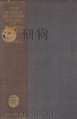
《the middle silurian rocks of north wales》
| 作者 | P.G.H.BOSWELL 编者 |
|---|---|
| 出版 | EDWARD ARNOLD & CO |
| 参考页数 | 448 |
| 出版时间 | 1949(求助前请核对) 目录预览 |
| ISBN号 | 无 — 求助条款 |
| PDF编号 | 813814568(仅供预览,未存储实际文件) |
| 求助格式 | 扫描PDF(若分多册发行,每次仅能受理1册) |
PART Ⅰ. GENERAL1
1. INTRODUCTION1
1.1. Distribution1
1.2. West Denbighshire1
1.3. East Denbighshire, Flintshire, etc3
1.4. Lithological changes and correlation4
1.5. Condition of deposit and rate of accumula-tion6
1.6. Geological history of the region8
1.7. Scenery13
1.8. Superficial deposits16
1.9. Economic products, water supply19
1.10. Making the map27
1.11. Problems outstanding29
2. STRATIGRAPHY30
2.1. Zone of Cyrtograptus murchisoni30
2.2. Zone of Mono-graptus riccartonensis31
2.3. Zone of C. symmetricus31
2.4. Zone of C. linnarssoni32
2.5. Zone of C. rigidus33
2.6. The Denbighshire Grits and Flags Series35
2.7. Zone of C. lundgreni37
2.8. Monograptus-dubius Beds38
2.9. Zone of M. vulgaris39
2.10. Zone of M. nilssoni39
2.11. Zone of M. scanicus48
2.12. Zone of M. tumescens53
2.13. Zone of M. leintwardinensis56
2.14. Dinas-Bran Beds57
2.15. Thicknesses of Subdivisions57
2.16. The Valentian-Salopian boundary60
2.17. The Diagnostic Value of Grapto-lite Assemblages63
3. STRUCTURE : FOLDING, FAULTING AND JOINTING66
3.1. Folding67
3.2. Faulting72
Jointing90
4. OTHER STRUCTURAL FEATURES96
4.1. Cleavage96
4.2. Intraformational and other Disturbance of Bedding109
4.3. Land-forms125
4.4. General dis-cussion of Structural Features126
4.5. The Regional Tectonic Pattern129
5. PETROGRAPHY134
5.1. Lithology and Mineralogy134
5.2. Density of the Rocks135
5.3. Texture and banding137
5.4. Chemical Com-position138
5.5. Characters as seen under the microscope138
6. PALAEONTOLOGY152
6.1. Graptolites153
6.2. Shelly faunas161
6.3. Faunas of the various zones163
7. HISTORY OF INVESTIGATION IN THE AREA166
Lists of published works171
PART Ⅱ. DETAILS OF AREAS177
8. THE DENBIGH DISTRICT178
8.1. General178
8.2. Denbigh and the Ystrad Section179
8.3. The country north-west of Denbigh,Llanefydd, Mynydd y Gaer, Moel Fodiar183
8.4. The country west and south of Denbigh, Eriviat, Tywysog, Rh?d-Galed, Groes, Moel Fechan, Foel Gasyth, Moel Prion, Moel Ytta190
8.5. Tributaries to River Clwyd between Denbigh and Pentre199
9. THE ABERGELE-LLANFAIR TALHAIARN DISTRICT (EASTERN SECTION)201
9.1. General201
9.2. Sanatorium Block203
9.3. Moelfre Isaf204
9.4. Plas-isaf Block204
9.5. Fron-fawr206
9.6. Mynydd y Gyrt and Beniar207
9.7. Pengwem208
9.8. Mynydd Bodrochwyn208
9.9. Mynydd Bodran211
9.10. Moel Iago and Cefn Treflech213
9.11. Dyffryn Aled to Mostyn Dingle215
9.12. Y Foel216
9.13. The Heskin Block216
10. THE ABERGELE-LLANFAIR TALHAIARN DISTRICT (WESTERN SECTION)219
10.1. The area west of the Llanfair faults, the Cynant Mass, Mynydd Du, Garthewin219
10.2. The area west of Garthewin, Bettws-yn-Rh?s, Moelfre Uchaf, Cae-eithin, Mynydd Glyn-Lws, Tollhouse area223
10.3. The Branar-Pentre Isaf district, Rhosmarch area, Mynydd Branar, Pentre Isaf area228
10.4. The country south of the River Elwy, the Pentre-du Block, south of Llanfair, Moel Unben, Ffrǐth Bedwyn231
10.5. Tre-pys-llygod, Moel Pentre-wern235
11. THE AREA LYING SOUTH-WEST, SOUTH AND SOUTH-EAST OF LLAN-SANNAN239
11.1. General239
11.2. The Aled Valley from Llyn Aled to Llansannan242
11.3. Tributary streams245
12. BYLCHAU AND THE CENTRAL MOORLAND AREA248
12.1. The Moorland south and south-west of Nantglyn248
12.2. The Bylchau district249
12.3. The area around the Sportsman’s Arms251
12.4. Mynydd Hiraethog, Llyn Aled to Mon Brenig, Alwen Reservoir, Afon Brenig to Pennant252
13. THE DISTRICT WEST OF LLANGERNIEW258
13.1. The Hafodunos area258
13.2. Gell to the Llyn Ty'n-y-llyn faults264
13.3. The Trofarth area266
13.4. The Wenlli fault-belt267
13.5. The district around Holland Arms269
13.6. The Llangerniew fault-system271
14. THE COUNTRY AROUND EGLWYS-FACH273
14.1. General273
14.2. The area between Bodnant and the Pentre-felin faults281
14.3. Nant Maes-Adda, Topan, Erw-g?ch and Deunant283
14.4. Llyn Syberi area286
14.5. Nant y Rhaglaw290
14.6. The Ty-mawr area293
14.7. The district south of Pentre’r Felin294
14.8. Pennant to Maenan295
15. THE COLWYN-CONWAY DISTRICT299
15.1. The Colwyn Area299
15.2. The Salopian rocks west of the Conway Valley303
15.3. The Salopian rocks north of the gap from Llandudno Junction to Mochdre309
15.4. The Glan Conway area311
16. THE LLANRWST DISTRICT314
16.1. General314
16.2. Llanrwst and the western margin324
16.3. Hendre House to Soflen326
16.4. Coed y Garth327
16.5. Area north of Melin-y-Coed328
16.6. The Llanrwst Stream section330
16.7. The Lladdoget area331
16.8. The Henblas area333
16.9. The Ll?yn-Goronwy district334
16.10. Afon Sychbant and Nant Bwlch-y-gwynt336
17. THE DISTRICT AROUND GWYTHERIN339
17.1. General339
17.2. The country south of Gwytherin342
17.3. The Pandy Tudyr area346
17.4. Farmyard to Rhwng-y-ddwyffordd, Pant-glas, Maelogen, Oerfa and Friddog347
17.5. The Cledwen Basin below Gwytherin349
17.6. The country south of Llangerniew352
18. THE COUNTRY FROM NEBO TO PENTRE VOELAS AND CERRIG-Y-DRUIDION353
18.1. The Nebo district, Moel Seisiog and Llyn Alwen353
18.2. The Country around Pentre Voelas355
18.3. The Cerrig-y-druidion Area358
19. THE RUTHIN-DERWEN AREA362
19.1. General362
19.2. The Clywedog section (Lady Bagot's Drive)364
19.3. The Ysgeibion area, Moel y Fron, Foel Ganol, Foel Uchaf, Meifod Block and Ffr?dd Fawr366
19.4. The country south and south-west of Ruthin, Llanfwrog to Efenechtyd, Pwll-glas to Nantclwyd, Clawdd-newydd to Derwen, Pool Park370
19.5. Nant Melin-d?r and south of Bont-uchel, Gyffylliog375
19.6. Clocaenog district377
19.7. Bryn Ocyn378
19.8. Clawdd-newydd to Pont Petryal380
20. THE LLANELIDAN DISTRICT382
20.1. The Llanelidan fault-system382
20.2. The country north of the main fault, the Derwen area383
20.3. The district between the main Llanelidan and Pentre faults384
20.4. The area north-west and west of Gwyddelwern386
20.5. The R?g district388
20.6. The country between Gwyddelwern and Llanelidan, Moel Truan390
20.7. The Ffynnon-Tudur area393
21. THE CLWYDIAN RANGE396
21.1. The Northern Part396
21.2. The North-central Area403
21.3. The Central Region412
21.4. The Southern End420
INDEX435
1949《the middle silurian rocks of north wales》由于是年代较久的资料都绝版了,几乎不可能购买到实物。如果大家为了学习确实需要,可向博主求助其电子版PDF文件(由P.G.H.BOSWELL 1949 EDWARD ARNOLD & CO 出版的版本) 。对合法合规的求助,我会当即受理并将下载地址发送给你。
高度相关资料
-
- A SYNOPSIS OF THE SILURIAN FOSSILS OF IRELAND
- 1846 M.H.GILL
-

- THE MIDDLE EAST AND NORTH AFRICA 1974-75
- 1982 EUROPA PUBLICATIONS LIMITED
-
- THE MIDDLE OF THE ROAD
- 1923 NEW YORK GEORGE H. DORAN COMPANY
-
- The Jarrold Book of The countryside of south wales
- 1977 Jarrold and Sons
-
- PALAEONTOLOGY OF THE SILURIAN ROCKS OF ARISAIG NOVA SCOTIA
- 1924 THE KING'S MOST EXCELLENT MAJESTY
-
- The fracture of rocks
- 1986 North Oxford Academic
-
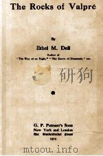
- THE ROCKS OF VALPRE
- 1914 G. P. PUTNAM'S SONS NEW YORK AND LONDON
-
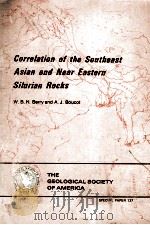
- CORRELATION OF THE SOUTHEAST ASIAN AND NEAR EASTERN SILURIAN ROCKS
- 1972 THE GEOLOGICAL SOCIETY OF AMERICA
-
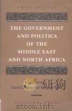
- THE GOVERNMENT AND POLITICS OF THE MIDDLE EAST AND NORTH AFRICA THIRD EDITION
- 1995 WESTVIEW PRESS
-

- THE RED ROCKS OF EDDYSTONE
- 1962 ARROW BOOKS
-
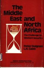
- THE MIDDLE EAST AND NORTH AFRICA THE CHALLENGE TO WESTERN SECURITY
- 1981 HOOVER INSTITUTION PRESS
-
- lesfossiles
- 1881 librarie hachette et CIE
提示:百度云已更名为百度网盘(百度盘),天翼云盘、微盘下载地址……暂未提供。➥ PDF文字可复制化或转WORD
